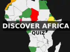
Location of African countries | Quiz
Africa – the world's second largest (about 30.3 million km2 / 11.7 million square miles = 20.3% of the total land surface on Earth) and second most-populous continent (1.2 billion people). Africa's average population with median age of 19.7 (data for 2012) is the youngest amongst all the continents.
Africa extends south and north of the equator mainly in the eastern hemisphere. For the most part, it is surrounded by oceans, on the east by the Indian Ocean and on the west by the Atlantic Ocean. In the north is the Mediterranean Sea, which separates Africa from Europe. In the Suezian region, this continent is linked to the Eurasian Plate.
Africa is composed of 54 fully recognised sovereign states (countries). Do you know them all, and would you be able to find them on the map? Try it in this geo quiz.
List of 54 African countries:
- Angola
- Burundi
- Benin
- Burkina Faso
- Botswana
- Central African Rep.
- Côte d'Ivoire
- Cameroon
- Dem. Rep. Congo
- Congo
- Djibouti
- Algeria
- Egypt
- Eritrea
- Ethiopia
- Gabon
- Ghana
- Guinea
- Gambia
- Guinea-Bissau
- Eq. Guinea
- Kenya
- Liberia
- Libya
- Lesotho
- Morocco
- Madagascar
- Mali
- Mozambique
- Mauritania
- Malawi
- Namibia
- Niger
- Nigeria
- Rwanda
- W. Sahara
- Sudan
- S. Sudan
- Senegal
- Sierra Leone
- Swaziland
- Chad
- Togo
- Tunisia
- Tanzania
- Uganda
- South Africa
- Zambia
- Zimbabwe
- Somali
Location of African countries game is part of educational geography games on PacoGames.
Related games:

Leave a comment for Location of African countries | Quiz
To leave a comment you must be logged in
Comments order:
Top comments